7-Day Mount Baker and Weismann’s Peak Trek via Kilembe Trail
The 7-Day Mt. Baker and Weismann’s Peak Trek is a challenging, highly scenic expedition in Uganda’s Rwenzori Mountains. Utilizing the Kilembe Trail, the route takes hikers through lush bamboo and alpine zones, culminating in a 4,842m summit of Mount Baker and an ascent of Weismann’s Peak (4,620m).
Mount Baker’s Edward Peak (4,843 m) and Weismann’s Peak (4,620 m) can only be reached on this guided Rwenzori trek. The Kilembe Trail winds its way through cathedral forest, strange Afro-alpine bogs, and the famous Bamwanjara Pass over the course of seven days. At the end of the trek, you’ll descend down the stunning Nyamwamba Valley canyon after two days of summiting. Here you may get the complete Kilembe experience without having to deal with Margherita’s glacial demands.
In just seven days, you can ascend Mount Baker (4,842 m) and Weismann Peak (4,620 m) in Uganda’s Rwenzori Mountains along the picturesque Kilembe Trail. Join Rwenzori Trekking Safaris to discover the abundant wildlife, breathtaking glacial views, and lush Afro-montane forests.
On a 7-Day Mount Baker and Weismann’s Peak Trek to the Rwenzori Mountains with Rwenzori Trekking Experts, you will witness two famous peaks: Mount Baker (Edward Peak, 4,842 m) and Weismann Peak, 4,620 m. This climb is ideal for the athletic hiker who prefers to avoid the crowds in Margherita and still enjoy breathtaking views of the Alps. Up there, you may see the glaciated peaks of Mount Stanley in all its glory and get up close and personal with the mountain’s rare and exotic wildlife.
A mountain in Uganda’s Rwenzori Mountains National Park, Mount Baker (or Kiyanja) is about 2.8 km from the border with the Democratic Republic of the Congo. Climbing 4,844 meters in just 7-Day Mount Baker and Weismann’s Peak Trek.
A beautiful but little-known mountain in the Rwenzori range is Weismann Peak. Mount Baker and Mount Luigi di Savoia are in close proximity to it. Located on the Central Circuit, the primary trekking circuit, the Kilembe Trail—run by Rwenzori Trekking Services—provides a more scenic and serene alternative for most visitors. Because of how easy Weismann Peak is, you can climb it without crampons or ropes for the most of the year. Compared to Mount Stanley and Mount Baker, this peak is distinct. It takes strength and skill to climb at high altitudes because of the elevation and the rough terrain.
Why Choose the 7-Day Mount Baker and Weismann’s Peak Trek?
This 7-Day Mount Baker and Weismann’s Peak Trek is notable for its dual-summit structure, which is a crucial distinguishing feature. You can reach one peak on the 6-day Weismann’s Peak adventure. Walking the Kilembe Trail, which takes eight days, leads to Margherita Peak across glaciers. Located in the exact center of the Kilembe Trail, this 7-day route encompasses two designated Rwenzori summits that may be reached as high-altitude hiking peaks without crampons or ropes beyond safety lines on Baker’s tougher rock portions. This combo is not offered by any other 7-Day Rwenzori Trekking itinerary.
The third-highest massif in the Rwenzori, Mount Baker (4,843m), is also one of the most infrequently climbed significant peaks in the range. Locals name it Kiyanja. The summit of Edward Peak, which is located 2.8 km from the border with the Democratic Republic of the Congo, offers sweeping views of the inner Rwenzori to the north and east and vistas across Mount Stanley (5,109m) to the northwest. From Hunwick’s Camp, the ascent is a rough and difficult affair. There are actual frozen rock faces during the wet season, and your guide will always utilise safety ropes on the most exposed portions. Competence in addition to physical fitness is required to conquer this peak. With knowledgeable guides, it’s not dangerous, but it’s definitely not a stroll in the park.
The next day, we climb Mount Luigi di Savoia’s Weismann’s Peak (4,620 m), which is reached from Hunwick’s Camp by way of Oliver’s Pass. This is an entirely different route than the one leading up Baker’s summit; we traverse a new landscape and enjoy a different set of vistas. There is no other Rwenzori route that offers the unique opportunity to stand atop Baker and gaze across Weismann’s ridge on Day 5, and then atop Weismann’s and gaze back at Baker’s summit on Day 6. After starting from the same base camp 24 hours apart, these two viewpoints on the same interior mountain environment couldn’t be more different.
The straight and rigorous nature of the Kilembe Trail makes it the ideal approach for both summits. The Kilembe Trail cuts through the Nyamwamba Valley and heads directly into the heart of the Rwenzori Mountains, in contrast to the Central Circuit’s circuitous route around the peripheral range. On day one, you gain 1,146 meters. On the third day, you will have tented at Bugata (4,100 m) and can see the summits of both targets in the distance. Although the approach is more challenging than the Central Circuit, the payoff is a less crowded, more authentically secluded mountain experience.
A Detailed 7-Day Mount Baker and Weismann’s Peak Trek Itinerary
Day 1: Kilembe Trailhead → Sine Camp (~1,450 m → 2,596 m) | ~9.5 km
Hiking time: 5–7 hours | Elevation gain: +1,146 m | Overnight: Sine Camp (2,596 m)
Starting at Kilembe: The Rwenzori’s Southern Gateway
Rwenzori Backpackers Hostel (Trekkers Hostel Kilembe) in Kyanjuki is the starting point for your 7-Day Mount Baker and Weismann’s Peak Trek. The town of Kasese is just 35km away, and the trek takes around 40 minutes by road. It is highly recommended that you arrive the night before your start date. At Kilembe, you will be introduced to your guide and porter, your permission will be verified, your load will be distributed, and your equipment will be checked. A 7:00 AM departure on Day 1 depends on a trouble-free morning. The precise needs of this two-summit itinerary, as well as route structure, altitude control, and emergency measures, are covered in the pre-trek briefing at the trailhead.
Every hiker should know before they set out that this is a traverse from one place to another. Starting from Kilembe, you will reach a different trailhead some 20-30 minutes away by road on Day 7, where you will exit via the Nyamwamba Valley. In order to return to Kasese or your lodging, you must prearrange a vehicle transport from the Nyamwamba exit. As a part of our service, we will arrange for the transfer.
The Afro-Montane Forest Ascent
Into the woods of the lower Nyamwamba Valley, the path quickly begins to descend. The Kilembe Trail does not provide a flat segment to warm up, therefore the approach is steep from the first few meters. At this altitude, you can find an old Afro-montane rainforest with ferns, orchids, and flowering shrubs in the understory and towering hardwoods covered in epiphytic moss and lichen. Since 1994, this valley has been protected by Rwenzori Mountains National Park, a UNESCO World Heritage Site. The forest here is dense and calm, like a truly untouched habitat.
The lower Nyamwamba Valley is a great place to see primates. Various monkey species can be seen along the trail, including black-and-white colobus monkeys (Colobus guereza), blue monkeys (Cercopithecus mitis), and the sacred L’Hoest’s monkey (Allochrocebus lhoesti), which the Bakonzo people revere as a protector of tradition. From the nearby woods, you can occasionally hear distant chimpanzee calls reverberating across the valley. It is also worth taking the short diversion around the 2,000m mark to see Enock’s Falls, a stunning cascade surrounded by lush riparian flora.
The trail gradually ascends through the forest, crosses multiple clear mountain streams, and then, at an elevation of over 2,000 meters, the flora starts to give way to bamboo. Sine Camp (2,596m), in a sheltered clearing next to a stream, surrounded by the first tree heather pushing through the upper bamboo, is reached after 5-7 hours. Here you will enjoy the most pleasant camp of the excursion, complete with a full hot three-course dinner and night temperatures ranging from 10 to 14°C.
Day 2: Sine Camp → Mutinda Camp (2,596 m → 3,582 m) | ~6.1 km
Hiking time: 6–8 hours | Elevation gain: +986 m | Overnight: Mutinda Camp (3,582 m)
Bamboo Zone, Ridge Crossings, and Kalalama Camp
Arrival to Sine Camp for breakfast at 7:00 AM and then leave at 7:30 AM. Beginning with a tough ascent in the morning, the second day of the Mount Baker and Weismann Peak journey passes through the Bamboo-Mimulopsis Zone, a thick stand of mountain bamboo (Arundinaria alpina) whose towering culms produce a verdant tunnel effect. During the rainy season, this area is notoriously slick and muddy; when the weather is dry, the terrain is firm yet consistently steep. On bamboo stems at eye level, you may often see three-horned chameleons (Trioceros johnstoni), a species native to the Rwenzori region. Their bizarre colouring blends in beautifully with the green, filtered light.
At about 2,900 meters, the trail crosses into the Heather-Rapanea Zone, which is above the bamboo. Over time, the bamboo canopy gives way to tree heather (Erica arborea and Erica trimera) covered in Usnea lichen. The environment takes on a more sculpted and open appearance, and ridge crossings offer brief panoramic vistas of the Nyamwamba Valley below. Located at an elevation of 3,147 meters, the modest Kalalama Camp provides a pleasant mid-afternoon break with hot beverages and meals next to a mountain stream. From Kalalama to Mutinda Camp, there is a 1.8-kilometer rise that gains 551 meters. It is one of the steepest sustained climbs on the trip, but the payoff is worth it when you see the first open views of the alps after leaving the heather forest.
Optional: Mutinda Lookout Acclimatisation Hike
Mount Mutinda Camp (3,582m) is located in a shady alpine bowl next to a mountain stream. Once you arrive in the early afternoon, your guide will offer you the opportunity to go on an acclimatisation climb to Mutinda Lookout (3,975m). The hike takes 2-3 hours each way and comprises a 387m gain. As you stand on the lookout on a sunny afternoon, you can make out the Rwenzori mountain range stretching out below you, the town of Kasese in the Western Rift Valley, Lake George in the distance, and, for the first time, you can make out Mount Baker and Weismann’s Peak, the two peaks you will ascend in the next four days.
This acclimatisation walk should not be considered optional for anyone taking the altitude challenge seriously; it is strongly recommended. One surefire way to lessen the likelihood of altitude sickness is to follow the “climb high, sleep low” method, which entails increasing one’s altitude throughout the day before descending to a lower altitude at night. This itinerary’s main built-in altitude buffer is the Mutinda Lookout walk. For the full altitude management plan, see the Rwenzori acclimatisation handbook.
Day 3: Mutinda Camp → Bugata Camp (3,582 m → 4,100 m) | ~8.6 km
Hiking time: 4–6 hours | Elevation gain: +518 m | Overnight: Bugata Camp (4,100 m)
The Afro-Alpine Moorland: Giant Lobelias and Namusangi Valley Waterfalls
On the third day of the climb, the Kilembe Trail emerges from the heather forest and into the spectacular Afro-alpine zone, which transforms the Rwenzori into one of the world’s most botanically stunning mountains. This section of the trail is the most visually striking of the entire climb. The trail ascends from Mutinda Camp and winds its way across the expansive Mutinda Valley. Along the way, you’ll come across tussock grass, everlasting flowers (Helichrysum stuhlmannii), and the initial giant lobelias (Lobelia wollastonii), which can reach a height of four to five meters and have silvery rosettes that sparkle in the morning sun. Across the broad moorland, stands of architectural plants are formed by giant groundsels (Senecio adnivalis). This change is completely unprepared for by the lower zones.
Ascending into the Namusangi Valley (at an elevation of around 3,840 meters), the Kilembe Trail passes through one of the most picturesque side valleys. On either side of the valley, you’ll see vertical waterfalls, with white water crashing against dark rock at heights of 30 to 50 meters. When you stand at the top of Namusangi and look back down the valley, you can make out the Mutinda Peaks in the distance. In the direction of Bugata Camp, the wide upper Namusangi Valley spreads out ahead.
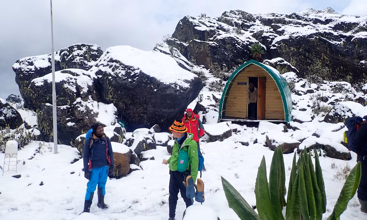
Bugata Camp: The Best-Equipped High Camp on the Kilembe Trail
Within the setting of the Rwenzori, Bugata Camp (4,100m) stands out. Solar lighting in the sleeping huts, a kitchen and dining shelter, composting toilets, access for emergency helicopter landings, and warm shower facilities (cold by lowland standards but remarkable at 4,100m) are some of Bugata’s unique features compared to other mountain huts. At 4,100 meters, any medical evacuation would be costly and logistically difficult without access to air, thus your travel insurance becomes practically relevant at this point. Make sure you have the right coverage by reviewing our Rwenzori travel insurance guide before you leave.
The views from Bugata are very breathtaking. The valley below is home to shimmering Lake Kopello, while the ridgeline above draws attention to Bamwanjara Pass and the central Rwenzori massifs beyond. The northeastern slopes of Mount Baker may be seen out, while further along the same ridge Weismann’s Peak rises like a blade. In the next three days, you will reach the peak of both of those mountains. Occasionally, around dark, the endemic subspecies of the Rwenzori Red Forest Duiker (Cephalophus nigrifrons rubidus) would emerge near Bugata Camp to feed on the residual foliage at the camp’s edge.
Day 4: Bugata Camp → Bamwanjara Pass → Hunwick’s Camp (4,100 m → 4,450 m → 3,974 m) | ~8.3 km
Hiking time: 7–9 hours | Pass gain: +350 m | Net descent to Hunwick’s: −476 m | Overnight: Hunwick’s Camp (3,974 m)
Crossing Bamwanjara Pass (4,450m)
Leaving the Kilembe approach side of the range and entering the inner Rwenzori world, where both summits await, is an incredible crossing that takes place on day four. Start your day with breakfast at 6:30 and be ready to hit the road by 7:00. Bamwanjara Pass, at 4,450 meters, is the highest point of the approach section and one of the most remarkable perspectives in the Rwenzori Mountains. The trail ascends a lengthy ridge from Bugata Camp to get there. At the pass is a little emergency shelter house that serves as a windbreak during bad weather.
Mount Stanley (5,109m) stands tall to the northwest, with its Stanley Glacier visible as a bright band. Mount Baker (4,843m) stands to the northeast, your first summit target, now close enough to study the approach line. To the north, Mount Speke (4,890m) appears; and to the east, Weismann’s Peak. On clear mornings at Bamwanjara Pass, the entire panorama of the inner Rwenzori unfolds before you. Here, for the first time, is the complete expedition geometry: the two peaks, separated by a single night at Hunwick’s Camp, set out before you.
Descent to Hunwick’s Camp Through the Alpine Bogs
The route descends into the inner Rwenzori valleys from the pass, avoiding alpine bogs at high elevations. Approach the lobelia stands silently and observe the sunbirds methodically feeding on the flower spikes of the gigantic lobelia plant; the Malachite Sunbird (Nectarinia johnstoni) is native to the Rwenzori and Virunga mountains and this zone is where it nests and feeds. On the open terrain, you can see common ravens, and occasionally you can see augur buzzards flying over the peak.
Hunwick’s Camp (3,974m) offers a breathtaking view of the surrounding mountains from its vantage point on the edge of a deep valley. On Nights 4 and 5, you will be sleeping at the expedition’s base camp, which serves as the starting point for both summit days. In comparison to the 6-day Weismann route, this extra night allows you a full day of relaxation between the Baker and Weismann summits. There is a separate kitchen shelter and bed platforms that can accommodate 12–16 people in the hut. Lows of less than freezing point are common at night. At Hunwick’s, each layer is important.
Day 5: Summit Mount Baker Edward Peak (4,843 m) 3,974 m → 4,843 m → 3,974 m | ~10 km round trip
Hiking time: 6–8 hours | Summit gain: +869m from Hunwick’s | Return to Hunwick’s overnight
Early Departure for Edward Peak
At five in the morning, your guide will come and get you. Starting in the dark and frigid Hunwick’s Camp, the day of summiting Mount Baker begins, with temperatures usually falling between 3 and 6 degrees Celsius before daylight. Put on all of your warmest outerwear, including a thermal base, fleece, insulated jacket, waterproof shell, cap, and gloves, before venturing outside. Before beginning the ascent in the light of headlamps around 5:30 or 6:00 in the morning, breakfast consists of hot beverages and biscuits.
There is no more technically challenging part of this entire 7-day trek than the climb of Mount Baker to Edward Peak (4,843m). From Hunwick’s, the path ascends precipitously across exposed, rocky terrain. The rock is hard underfoot in the dry season (January–February and June–August), and traction can be managed with stout waterproof hiking boots. No matter the season, your guide will always use safety ropes on the steepest areas because the exposed rock walls can be ice-coated and particularly dangerous during the wet seasons (April–May and September–October). Although it is not a glacier climb, this mountain ascent requires constant focus.
The Mount Baker Summit: Edward Peak (4,843m)
At 4,843 meters, Edward Peak is the third-highest peak in the Rwenzori Mountains and the highest point on Mount Baker. A little scramble through a fissure in the granite cliff separates you from the peak for the last few meters. When the weather is clear in the mornings, Edward Peak offers one of the best views of the Rwenzori mountains. From the northwest, Mount Stanley’s Margherita Peak (5,109m) and Alexandra Peak (5,091m) emerge from the clouds; the Stanley Glacier is illuminated by the first rays of morning light. When the weather is perfect, the foothills of the Ruwenzori Mountains may be seen stretching westward into the Democratic Republic of the Congo, all the way to Lake Edward, and the boundary with the DRC is just 2.8 km farther south.
You won’t want to spend more than 20 to 40 minutes at the peak due to the cold, wind, and drop. This is Africa’s tenth highest peak, so taking pictures here is a real accomplishment, but soon enough it will be time to descend. With weary legs navigating steep, rocky terrain, the down-climb requires the same amount of concentration as the ascent. After a nice meal, most groups return to Hunwick’s Camp around midday.
Rest Afternoon at Hunwick’s Camp
Being able to spend the remainder of Day 5 at Hunwick’s Camp is a real perk of the 7-day plan compared to the 6-day Weismann’s approach. At 3,974 meters, you have some downtime after the Baker summit to recover from the exercise, replenish your fluids, fuel your body, and be ready for tomorrow’s summit of Weismann’s Peak. Get some rest because the second peak day starts bright and early once more.
Day 6: Weismann’s Peak via oliver’s Pass → Kiharo Camp (3,974 m → 4,620 m → 3,460 m) | ~15.8 km
Hiking time: 9–12 hours | Summit gain: +646m from Hunwick’s via Oliver’s Pass | Descent to Kiharo: −1,160m | Overnight: Kiharo Camp (3,460m)
The Second Summit: Weismann’s Peak via Oliver’s Pass
Day 6 follows a different format than Day 5. You won’t be returning to Hunwick’s; instead, you’ll be attempting a peak and starting the lengthy descent out of the inner Rwenzori. So, bring all of your stuff. Headlamps will once again be required for the 5:30 AM departure. Moving across the inner mountain terrain in the other way as yesterday, the path from Hunwick’s Camp initially takes the track toward Oliver’s Pass instead of the Baker approach line.
Located three km from Hunwick’s Camp, Oliver’s Pass is a narrow saddle between peaks at an elevation of about 4,200 meters. Similar to the Baker approach but without the areas involving ice-risk, the climb to Weismann’s Peak (4,620m) via Oliver’s Pass is steep but passable rocky terrain. A rocky ridge called McConnell’s Prong serves as the straight approach to the peak. When it’s dry, you won’t need ropes, but when it’s raining, your guide will decide that for you.
Standing on Weismann’s Peak (4,620m)
The small rocky crest at the top of Weismann’s Peak is exposed on all sides. At Baker’s top, you could have looked across at Weismann’s, but now you can see back at Baker, which is a very different and illuminating view. One of the most memorable aspects of this two-summit adventure is the geometric relationship between the two peaks, which may be observed from different sides on consecutive mornings. In the dawn light, the Kitandara Lakes basin shimmers to the south, while Margherita Peak is once again visible to the northwest. From time to time, the Virunga volcanoes can be made out on the horizon of the DRC.
At 4,620 meters, Weismann’s Peak is the eleventh tallest peak in Uganda. If you stand here the day after Edward Peak, the tenth highest peak in Uganda, you will have stood on both the tenth and eleventh highest summits in just 48 hours. This ascent is a significant double for hikers who are aiming to summit the Rwenzori Mountains. The lengthy fall starts after the first twenty to forty minutes of Day 6.
Descent to Kiharo Camp via the Kitandara Basin
The downhill route from Weismann’s Peak goes via the Kitandara basin, which is one of the most picturesque alpine valleys in the Rwenzori Mountains, and into the upper Nyamwamba Valley. Located at an elevation of around 4,023 meters in a basin formed by glaciers, the Kitandara Lakes are another stop along the Central Circuit Trail. On days when the weather is quiet, the black water of these lakes remains completely motionless. Along the edges of the lake, you can see lobelias and giant groundsels. From boulder fields around, you can hear the call of rock hyraxes.
As one descends the upper Nyamwamba Valley, one passes through a succession of landscape types, including high alpine bog, glacial moraine, and first sub-alpine scrub, as the flora gradually fades. As you descend from higher ground, you’ll see more Rwenzori Red Forest Duikers hanging around in the underbrush. In contrast to Hunwick’s Camp’s exposed location, Kiharo Camp (3,460 m) is tucked away in thick evergreen greenery next to a babbling brook. Two peaks will have passed you by the time you reach your destination. It takes time to fully grasp that truth.
Day 7: Kiharo Camp → Nyamwamba Valley exit → Kilembe Basecamp (3,460 m → ~1,480 m) | ~16 km
Hiking time: 7–8 hours | Elevation loss: −1,980m | End of expedition
The Nyamwamba Valley Gorge: A Grand Finale
The seventh day of climbing Mount Baker and Weismann Peak is a physically challenging descent, but it is also one of the most visually beautiful days of trekking in the Rwenzori. A series of powerful waterfalls, canyon walls covered in moss, deep forest gorges, and numerous river crossings that demand careful footwork even when your legs are tired make up the Nyamwamba Valley gorge, which has been carved into the ancient crystalline rock of the Rwenzori Mountains by glacial meltwater over millennia. Some of the fall follows the valley floor, while other sections go high above it on rocky ledges; what makes this descent unique is the contrast between the two settings, which are close and confined one moment and exposed and vertiginous the next.
For every 100 meters of elevation loss, wildlife activity rises. Above 2,500 meters, you can see colobus and blue monkeys returning to the canopy, rock hyraxes (Procavia capensis) populating each boulder field, and Rwenzori Red Forest duikers making their way through the understory. As the mountain forest regenerates around the trail, one can hear the chorus of forest birdsong and the rustle of underbrush from frightened duikers.
Riverside Rock Shelter and the Final Forest
Riverside Rock Shelter, a natural ledge next to the river that has long been used as a picnic spot for lunch on Day 7, continues this tradition. One of the most rejuvenating lunch stops on the Rwenzori route, thanks to the soothing sound of the water and the cool shadow of the rock. Walking past the shelter, you’ll reach the last stretch of forest before you bridge the river and reach the park boundary, where you can exit.
Your expedition logistics will include arranging for a return car to wait at the Nyamwamba Valley exit point. Twenty to forty minutes is the approximate time it takes for the transfer to return to Kilembe, Kasese, or Fort Portal. The exit is the perfect spot for group photos with your guide and porters, the tipping ceremony (for details, see out our Rwenzori tipping guide) and that refreshing drink you’ve been fantasising about since Bamwanjara Pass. In just over 24 hours, you have conquered two of the eleven highest peaks in Uganda. Give it some thought.
End of the 7-Day Mount Baker and Weismann’s Peak Trek Itinerary